LiDAR Pilot Program Launched at Shady Rest
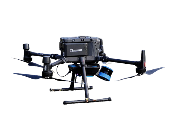
Our mission has always been to deliver healthier forests and more resilient ecosystems. This quarter, we’ve taken a major leap forward in how we monitor treatment outcomes by deploying LiDAR drone technology at our Shady Rest project site. This technology complements our existing drone program and allows our Forest Health Team to gain a new level of detail and accuracy in our forest ecosystems. We have been testing this technology at Shady Rest and plan to formally integrate it into our drone program later this fall. Ultimately, more and better data means faster decision making and better land stewardship outcomes.
What is LiDAR?
LiDAR, which stands for Light Detection And Ranging, is an active remote sensing technology that uses a rapidly firing laser to measure distances to objects. Mounted on a drone, the LiDAR sensor emits hundreds of thousands of light pulses per second. These pulses travel to the ground, reflect off tree branches and the forest floor, and return to the sensor.
By measuring the exact time it takes for these pulses to return, the system creates a dense, three-dimensional “point cloud”—a highly accurate digital map of the entire forest structure.
Precision Data for Real-Time Results
Using UAV-borne (drone) LiDAR allows us to capture data at lower altitudes and slower speeds than planes or satellites, resulting in an incredibly high number of data points per square meter. This gives us accurate, timely information on the key metrics that define a healthy forest:
- Stand Density: We can isolate and count individual trees across large areas, allowing us to see exactly how many trees are in a stand
- Canopy Cover: LiDAR provides a precise percentage of the landscape covered by tree canopy, which helps us understand wildlife habitat and fire risk.
- Forest Spatial Patterns: This data allows us to quantify the distribution of trees and thus whether they are evenly spaced, randomly distributed, or clustered, and if there are canopy gaps. This is critical metric to assess as healthy, resilient forests in this area have a mix of individual trees, small groups of trees, and open spaces.
- Biomass: Because LiDAR measures the full vertical structure of the forest, it provides us with an estimate of biomass. Biomass calculations are becoming increasingly more important as we face an issue in the Eastern Sierra with a lack of infrastructure to process the fuel loads being removed from the landscape. Accurate biomass calculations also help us estimate carbon storage to understand how our work is impacting the local carbon cycle.


Turning Data into Action- The Shady Rest Pilot
The power of drone technology lies in how effectively we apply it to forest management. At Shady Rest—a popular recreation area for our community—we are piloting LiDAR technology to measure how our on-the-ground treatments align with our original design goals.
While our drone program already utilizes RGB and multispectral imagery to monitor project sites before and after implementation, LiDAR adds a new layer of insight. By pairing standard imagery with LiDAR, we can detect if a thinning treatment falls short of tree density and forest structure targets, providing a more comprehensive evaluation of treatment effectiveness.
Catching these discrepancies early allows us to make real-time adjustments, ensuring every treatment actively promotes a healthy, resilient forest. By blending field expertise with cutting-edge technology, Whitebark Institute is helping Shady Rest—and other lands we work on—thrive for generations to come. We look forward to rolling out this technology across more of our project sites soon!