Planning for the Future
The West Mono Basin Resilience Project is a collaborative effort to improve the long-term health and resilience of forests, watersheds, and communities throughout the West Mono Basin. Led by the Inyo National Forest in partnership with Whitebark Institute and numerous local, Tribal, state, and federal partners, the project is currently in the planning phase and will guide future forest health and wildfire resilience efforts across the watershed.
The project aims to create healthier ecosystems that are better able to withstand wildfire, drought, insects, disease, and a changing climate while continuing to provide the many ecological, cultural, and recreational benefits the West Mono Basin is known for.
Why This Project Matters
For thousands of years, wildfire played an essential role in maintaining healthy landscapes and watersheds throughout the Eastern Sierra. Frequent, low- to moderate-intensity fires naturally reduced excess vegetation, recycled nutrients, created diverse wildlife habitat, and helped landscapes adapt to changing environmental conditions.
Over the past 150 years, however, fire suppression, historic logging, livestock grazing, water diversions, invasive species, and other land use changes have fundamentally altered these natural processes. Many forests have become denser than they were historically, fuel has accumulated, and ecosystems have become less resilient to drought, insects, disease, and high-severity wildfire.
Today, the West Mono Basin faces many of these same challenges. Proactive planning and restoration can help reduce wildfire risk while improving forest health, protecting watersheds, supporting wildlife habitat, and increasing the resilience of surrounding communities.

The Planning Area
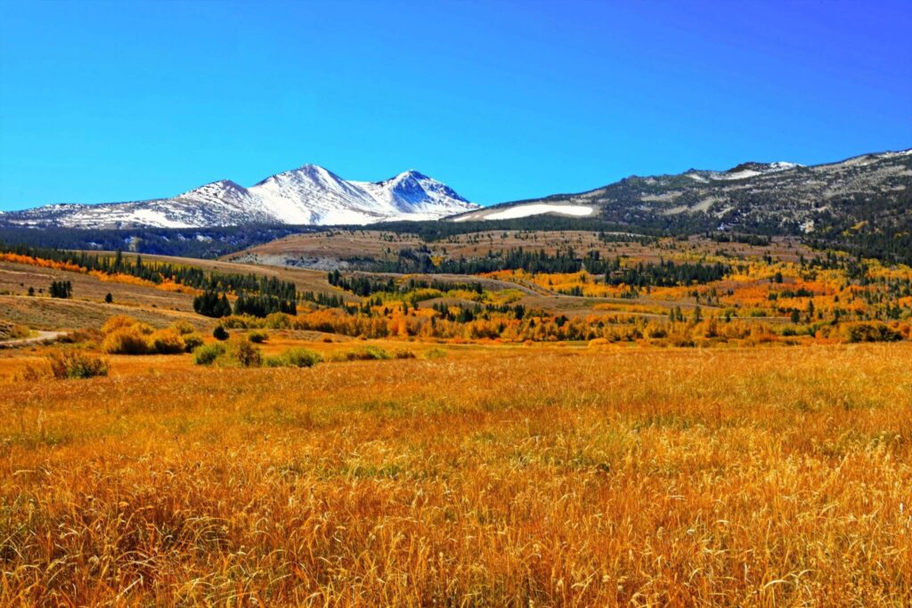
The West Mono Basin planning area encompasses approximately 160,000 acres of public and private lands that drain into Mono Lake, extending from the Sierra Crest eastward into the sagebrush flats. It includes the communities of June Lake, Lee Vining, and Mono City and is the ancestral homeland of Indigenous Peoples who have stewarded these landscapes since time immemorial.
The watershed contains a remarkable diversity of ecosystems, including sagebrush steppe, pinyon-juniper woodlands, riparian corridors, aspen groves, and mixed conifer forests. Because these landscapes cross multiple ownerships and management jurisdictions, successful restoration depends on close collaboration among land managers, community members, Tribal partners, local governments, nonprofit organizations, and other partners.
Whitebark’s Role
As a key partner in this effort, Whitebark is supporting planning, coordination, and communication among partners and the public and also providing support to the Inyo National Forest in the areas of project development, environmental compliance and public outreach.
The Inyo National Forest manages the majority of lands in the West Mono Basin Planning watershed and is considering opportunities for vegetation treatments, including ecological thinning, fuels reduction, and restoration activities that improve ecosystem health while enhancing protection for communities.
Project Objectives
1. Reduce the likelihood of high-intensity, high-severity wildfires
2. Improve community resilience to wildfire
3. Improve ecosystem resilience to wildfire and other disturbances
5. Improve the health of forests
6. Improve the health of aspen stands
7. Create conditions that promote reintroduction of prescribed and managed fire
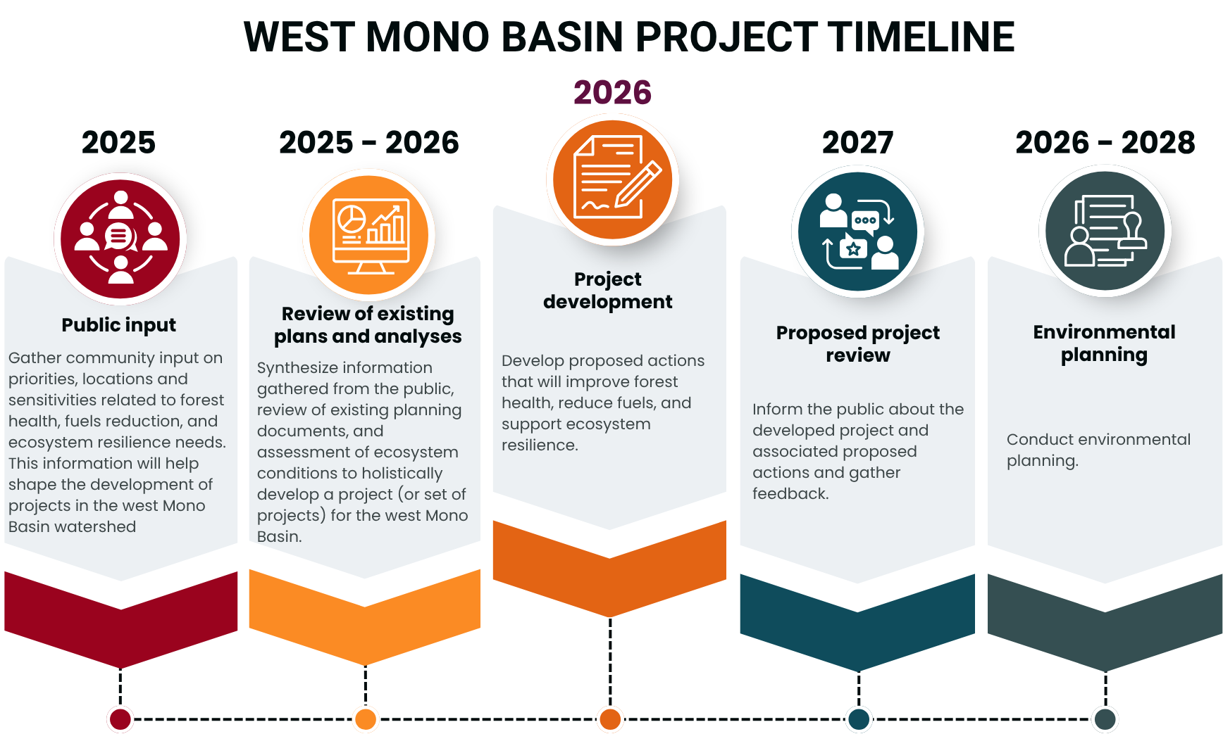
We are here: Project Development
The West Mono Basin Resilience Project is currently in the early stages of planning and project development.
During this phase, interdisciplinary teams of natural resource specialists, fire scientists, archeologists, and land managers are conducting field surveys and resource inventories, evaluating current conditions, modeling wildfire behavior, identifying areas of greatest wildfire risk, assessing opportunities for ecological restoration, and developing preliminary treatment strategies that maximize benefits for both ecosystems and nearby communities.
Our Environmental Planning team is actively using Planscape, an open source planning and ecological modelling tool developed through a collaborative effort involving the US Forest Service, California Universities and partners. Planscape integrates spatial data across multiple ecological and wildfire risk pillars to help land managers test wildfire scenarios, model treatment effects, and determine the best tools and tactics to treat landscapes. With this software we can highlight areas most out of alignment with the Natural Range of Variation and at highest risk for unnatural high severity wildfire.
At this stage, no decisions have been made regarding specific treatment locations or final restoration prescriptions. The information gathered during project development, together with public input and environmental analysis, will help shape future project proposals.
Large-scale projects requires careful planning. Before implementation can begin, specialists evaluate wildlife habitat, cultural resources, hydrology, recreation, wildfire behavior, and other natural resources to ensure restoration activities are both scientifically sound and responsive to community priorities.
Stay Connected
To stay informed about the latest developments and upcoming events, join our mailing list. Your involvement will help shape the future of the Mono Basin’s landscapes and communities.